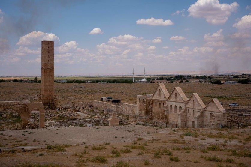
The examination of declassified photos obtained from Cold War-era spy satellites has revealed a hidden trove of Roman forts scattered across the deserts of Syria and Iraq.
This revelation has disrupted longstanding historical assumptions regarding the extent of the ancient Roman border in the Middle East.
Rediscovering Ancient Roman Forts in Middle East
Before this discovery, historians had documented approximately 100 Roman forts in this geographical expanse, with their origins primarily dating back to the second and third centuries A.D.
These forts were traditionally perceived as components of a defensive barrier designed to counter the Persian threat and safeguard against nomadic tribes. However, Interesting Engineering reported that a recent research investigation has presented a strikingly different narrative.
This study, which scrutinized imagery captured by American CORONA and HEXAGON satellites, has challenged established historical perspectives and provided a fresh account of the Roman Empire's presence in the Middle East.

Jesse Casana, an archaeologist from Dartmouth College who also serves as the lead author of this study, argued that the conventional interpretation of these forts as defensive structures at the border is fundamentally flawed.
Instead of being conceived as barriers to deter external threats, the recently revealed Roman forts seem to have functioned as crucial centers for caravan trade, military troop movements, and efficient communication networks.
Their strategic placement suggests a design that prioritizes the facilitation of people and goods, further underscoring their role as logistical hubs. National Geographic reported that this groundbreaking perspective has been pivotal in reshaping our understanding of Roman presence in the region.
Pioneering archaeologist and pilot Antoine Poidebard theorized that these forts were strategically positioned to be a protective barrier against incursions by Parthians, Sasanians, and nomadic tribes.
Read Also : Russia Could Be Setting Up the 'World's Longest Submarine' For the Cold War Under the Ocean
US Spy Satellites
However, Casana raised a critical point, saying Poidebard's survey suffered from a significant discovery bias. According to CNN, Casana noted that had Poidebard possessed the capability and technology to conduct comprehensive aerial surveys, he would have likely identified a significantly bigger number of forts.
Regrettably, the era's limitations seemed to constrain his ability to do so effectively. The turning point in understanding this historical puzzle emerged from the meticulous examination of detailed images captured by CORONA and HEXAGON spy satellites.
These US spy satellites, launched during the Cold War or between 1960 and 1986, reexamined the same geographical expanse of Poidebard's aerial explorations, ultimately revealing the presence of 396 additional Roman forts widely distributed across the northern Fertile Crescent.
Contrary to the traditional perception of a rigid, heavily fortified demarcation, the Roman eastern frontier emerges as a dynamic and fluid zone shaped by the constant flow of people, trade, and intellectual exchange.
Rocco Palermo, an archaeologist hailing from Bryn Mawr College, underscored the distinctive character of the Roman Empire's eastern border, which distinguished itself from other frontiers.
In this region, the Romans confronted not only "barbarian" adversaries but also contended with the formidable military might of the Persian empire.
Moreover, nomadic tribes in this area often functioned as intermediaries between these significant powers, adding further complexity to the regional dynamics.
Related Article : Former PLA Officer Suggests Cold War-Like Agreement Prevent US-China Tensions; Ex-US Defense Official Negates the Idea

ⓒ 2025 TECHTIMES.com All rights reserved. Do not reproduce without permission.


