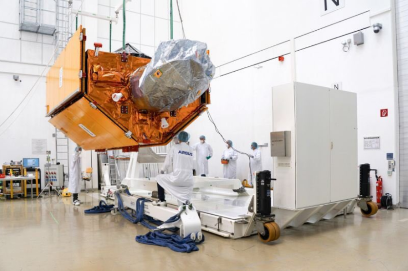
NASA and European Space Agency satellite reveal its latest super-advanced satellite, which can detect even the slightest changes in sea levels. The new technology called the Sentinel-6 Michael Freilich satellite can measure millimeter-scale changes in sea elevations.

California, here we come!#Airbus space engineers are preparing the European ocean satellite "#Copernicus #Sentinel-6 Michael Freilich" for its journey to Vandenberg. Next week, the satellite will leave from Munich Airport to the US. Launch: November, 10!@AirbusSpace @ESA_EO pic.twitter.com/udzqstoYWO — Dirk Hoke (@HokeDirk) September 16, 2020
NASA plans to send it to outer space on Nov. 10, blasting off from Vandenberg Air Force Base in California. The European Space Agency will provide additional information on Friday, Oct. 16, at 4 p.m. in Paris.
Business Insider explained that the satellite can detect changes from 830 miles above Earth. It will also update maps of oceans every ten days to show researchers and scientists how much rising sea levels are eroding the coastlines.
How powerful is the news satellite
Bloomberg first reported that the new satellite is powered by new high-tech digital altimeters that can bounce electromagnetic pulses off the planet's surface. The National Aeronautics and Space Administration, together with the European Space Agency, developed the new satellite.

"Measurements of global and regional sea level have become a valuable tool for decision makers to assess one of the most compelling impacts of climate change and how to prepare for flooding of coastal areas," said Paul Counet, EUMETSAT's strategy chief, via Bloomberg.
NASA partnered with SpaceX
The National Aeronautics and Space Administration (NASA) will work with SpaceX under a contract to launch the new satellite into an orbit 1,336 kilometers above Earth. The company's official website stated that it already re-flown 39 rockets from 93 total launches currently.
Now, it is planning to use the reusable first stage of the Falcon 9 rocket, which is expected to send off the Sentinel-6 Michael Freilich satellite and return to the original site at Vandenberg.
For more news updates about Elon Musk's new technology, always keep your tabs open here at TechTimes.
Related Article : WATCH: Jeff Bezos' New Shepard Space Rocket Did the Smoothest Landing in NASA Test
This article is owned by TechTimes.
Written by: Giuliano de Leon.
ⓒ 2025 TECHTIMES.com All rights reserved. Do not reproduce without permission.


