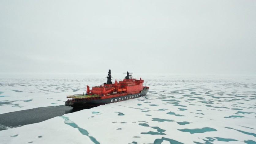
This summer, the US Coast Guard (USCG) icebreaker Healy embarks on a significant mission, traversing the North Pole while capturing images of the Arctic. The primary objective of this voyage is to advance the study of this rapidly evolving region.
To accomplish this, a team of researchers from Lincoln Laboratory has equipped the Healy with a new infrared imaging system, gathering a first-of-its-kind dataset for training AI analysis tools, MIT reported.

US Coast Guard Icebreaker Healy Capturing the Arctic Region
Jo Kurucar, a researcher in Lincoln Laboratory's AI Software Architectures and Algorithms Group, which led this project, underscored the dataset's importance, highlighting its potential to enhance navigation safety for mariners, improve operational efficiency, and bolster critical maritime domain awareness.
As the effects of global warming become increasingly evident and sea ice continues to melt, the Arctic is witnessing heightened maritime activity, which presents national security challenges for the United States.
Additionally, given the transformations in the Arctic's climate, wildlife, and geography, a comprehensive and profound understanding of the region becomes imperative, according to the research team.
MIT's report stated that the dataset gathered by Healy's camera system is a valuable and much-needed addition to the existing limited imagery datasets available for Arctic research.
While satellite and aircraft images offer some insights, a ship-mounted camera provides more detailed information and diverse perspectives of the environment, including nearby vessels.
These images serve as essential training data for AI computer-vision tools, offering valuable support to the USCG in planning naval missions and streamlining analysis, especially given the scarcity of resources in the Arctic.
Largest and Most Technologically Advanced
The icebreaker Healy, being the largest and most technologically advanced USCG vessel, was selected for this crucial mission. The research team collaborated with the USCG Research and Development Center to develop the Cold Region Imaging and Surveillance Platform (CRISP).
This system consists of a long-wave infrared camera from Teledyne FLIR, designed to withstand harsh maritime environments and capable of operating in challenging conditions such as darkness, fog, and glare.
Accompanying the camera, CRISP incorporates a GPS-enabled time-synchronized clock and a network video recorder, ensuring the recording of video and still imagery with accurate positional data.
Following the conclusion of the USCG science mission in the fall, the CRISP project team intends to make the dataset accessible to the public, facilitating broader research and fostering the development of advanced AI applications tailored to the Arctic.
By providing the dataset, Lincoln Laboratory seeks to expedite progress in AI applications while encouraging collaboration within the research community. Furthermore, the laboratory team intends to offer a baseline object-detection model, which will serve as a starting point for others to develop their own models.
In addition to aiding USCG missions, this project's dataset has the potential to play a crucial role in combatting climate change by facilitating AI-based research on Arctic data, according to the research team.
"This dataset not only can help mariners navigate more safely and operate more efficiently, but also help protect our nation by providing critical maritime domain awareness and an improved understanding of how AI analysis can be brought to bear in this challenging and unique environment," Kurucar said in a statement.
Related Article : Computer Scientists Develop 'De-Stijl' Tool With Adobe to Help People Use Color Better in Graphic Design

ⓒ 2025 TECHTIMES.com All rights reserved. Do not reproduce without permission.


