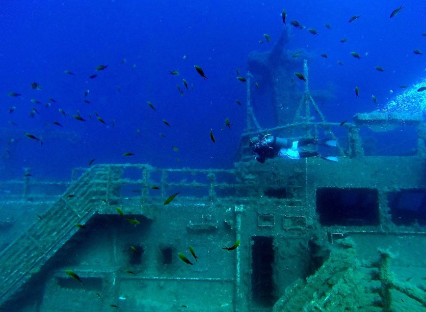
After nearly half a century, the long-lost shipwreck of the MV Blythe Star has finally been discovered, thanks to an investigation carried out by the CSIRO research vessel (RV) Investigator.

The Tragic Tale of MV Blythe Star
The MV Blythe Star, a 44-meter coastal freighter, vanished off the coast of Tasmania in 1973 during a voyage from Hobart to King Island. On October 13 of that year, the vessel unexpectedly capsized and sank, leaving the 10 crew members stranded.
They managed to escape onto an inflatable life raft, but unfortunately, three crew members lost their lives before the survivors were rescued 12 days later on October 24, 1973.
The vanishing of MV Blythe Star initiated a comprehensive maritime search, marking the largest in Australia's history up to that point. Nonetheless, despite exhaustive endeavors, no evidence of the ship could be uncovered, leaving the enigma unsolved for several decades.
During a 38-day research voyage commencing on April 12, 2023, with the primary objective of studying a submarine landslide off Tasmania's western coast, the RV Investigator successfully determined the precise location of the MV Blythe Star.
This scientific expedition, led by the University of Tasmania, also incorporated an additional project to investigate an unidentified shipwreck that had been previously detected by fishing vessels and seafloor surveys in the region.
These "piggyback" initiatives aimed to gather supplementary valuable data by capitalizing on existing voyage resources.
The investigation carried out by the RV Investigator encompassed a systematic mapping process of the unidentified shipwreck utilizing state-of-the-art multibeam echo sounders.
Following that, two underwater camera systems were used to conduct a visual inspection. The comprehensive mapping data analysis and video imagery conclusively established that the shipwreck corresponded to the MV Blythe Star.
Discovered in Tasmania
Located approximately 10.5 kilometers west of South West Cape, Tasmania, the wreck of the MV Blythe Star was discovered in an upright position on the seafloor, resting at a depth of 150 meters.
Significantly, the bow of the vessel was directed towards the northwest, and the examination unveiled unmistakable characteristics that confirmed its identity as the MV Blythe Star. Among these notable features was a visible section of the ship's name, "STAR," clearly discernible on the bow.
The shipwreck appeared to have a sparse growth of algae and seaweed, indicating minimal coverage. Some structural damage was noticeable, particularly at the stern of the vessel.
The wheelhouse was also absent, adding to the distinct characteristics of the wreck. Various marine creatures, such as crayfish, schools of fish, and fur seals, were observed near the wreck.
The data collected during this investigation will be shared with maritime heritage agencies at the state and national levels, contributing valuable information to the Australasian Underwater Cultural Heritage Database (AUCHD).
The mapping data and video footage hold the potential to provide deeper insights into the circumstances surrounding the tragic sinking of the MV Blythe Star.
The project's results have been communicated to significant stakeholders, including the Blythe Star Memorial Group, which intends to arrange an event in Hobart later this year to honor the 50th anniversary of the tragic incident.
Related Article : Lake Huron Shipwreck of Ironton in 1894 Recently Found Intact using NOAA's Ocean Mapping Tech

![Apple Watch Series 10 [GPS 42mm]](https://d.techtimes.com/en/full/453899/apple-watch-series-10-gps-42mm.jpg?w=184&h=103&f=9fb3c2ea2db928c663d1d2eadbcb3e52)


