Archaeologists have uncovered a fascinating discovery that sheds new light on the earliest inhabitants of Australia.
Using cutting-edge sub-surface imaging and aerial surveys, researchers from Flinders University were able to peer through the floodplains in the Red Lily Lagoon area of West Arnhem Land in Northern Australia.
According to their findings, this crucial terrain in the Northern Territory underwent changes as a result of sea level rise around 8,000 years ago.
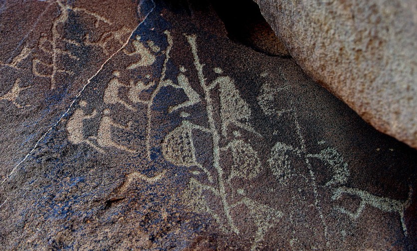
But the implications of their discovery go far beyond a mere understanding of the geography of the region. Their findings also offer a fresh approach to understanding the rock art in the area, which is popular for its unique style.

Beneath the Floodpains
Through an examination of the buried sediments beneath the floodplains, the researchers were able to discern how the metamorphosis of Red Lily Lagoon had engendered the proliferation of mangroves, which supported diverse animal and marine life where ancient Indigenous rock art is found.
This transition has created an environment that served as a muse for the subject matters and animals depicted in ancient rock art.
Dr. Jarrad Knowlessar, the Senior Author and Research Associate in the College of Humanities, Arts, and Social Sciences at Flinders University said that the mapping of the transformation of the Red Lily Lagoon had revolutionized archaeological comprehension of the landscape in Arnhem Land.
"This is a key landscape for understanding the early human occupation of Australia. Our reconstruction of Red Lily Lagoon enables effective predictive modeling of prominent cultural sites and provides an important method to interpret the presence and provenance of Indigenous cultural material," Dr. Knowlessar said.
The changes in the landscape that occurred as sea levels rose around 8,000 years ago are reflected in the timing and subject matter of the rock art found in the region.
The appearance of estuarine animals, such as fish and crocodiles, in the art coincides with the transformation of Red Lily Lagoon and the growth of mangroves, according to Dr. Knowlessar.
Similarly, the inclusion of freshwater species in the more recent artistic styles illustrates the phases of environmental change when freshwater floodplains dominated the landscape.
Pleistocene Sites
The significance of this discovery lies in the fact that all Pleistocene sites in western Arnhem Land were once situated near the ocean and mangrove swamps during the transformation of the landscape.
The significance of this discovery lies in its impact on the interpretation of changes in stone artifacts, food sources, and the isotope composition of materials from the ancient period of Australia.
It underscores the importance of taking into account the paleogeographic settings of these sites to better understand the transformations that occurred, according to the team.
The team utilized Electric Resistivity Tomography (ERT), a fast, inexpensive, and non-invasive approach, to gain a better understanding of the ancient history of the Australian landscape.
The study highlights how ERT data can be utilized to develop landscape models that are beneficial in comprehending known locations and predicting where buried archaeological sites are located at.
According to co-author Associate Professor Ian Moffat, this discovery has significant implications for locating new sites and developing a more comprehensive understanding of the regional geography and its influence on past human behavior.
The study was published in PLOS ONE.
Related Article : Archaeologists Unearth 3,500-year-old Ice Skates Made of Animal Bone


